


Contact Info
Ouachita National Forest
912 Smokey Bear Lane
Glenwood, AR 71943
912 Smokey Bear Lane
Glenwood, AR 71943
- Phone:
- 870-356-4186
Description
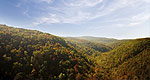
This trail offers the longest loop trail in Arkansas. A combination of the Little Missouri, the Athens- Big Fork and part of the Viles Branch Horse Trail, this trail travels through the southwestern portion of the Ouachita National Forest. Trail difficulty ranges from easy to most difficult. The trail crosses the Little Missouri River nine times and travels over nine mountains. There are also numerous creek crossings.
Surrounding Areas:
- Albert Pike Recreation Area, a well developed camping area, offers swimming, camping, and fishing opportunities.
- Little Missouri Falls, a forested picnic area, offers fishing and a trail to a waterfall overlook.
- For more hiking experiences in the area try the Caney Creek Trails.
Details
Additional Details:
History: This trail was developed along a 100 year-old postal route and old wagon roads in partnership with the Forest Service, the Student Conservation Association, Bayou Chapter of the Ozark Society and the Little Missouri Trails Council.
Surface type: Unsurfaced.Trail Markings: White rectangles.
Water: Albert Pike Recreation Area. Treat all lake and stream water before drinking.
Safety: Be careful when crossing river and creeks during periods of high water.

