


Contact Info
- Phone:
- 479-963-3076
Description
Mt. Magazine is in Logan County, Arkansas, which is 55 miles southeast of Fort Smith. At 2,753 feet above sea level, it's the highest mountain in the state. According to one of the many legends that have been recorded, "Magazine" was named by an officer leading a platoon of French soldiers in the early days of exploration for trade routes. It was given the name "Magazine" because its fortress-like rock foundation. Others say that the mountain was actually named for its use as a storage facility or "magazine" by the Confederate Army during the Civil War period. Regardless of which version is true, it is generally agreed upon that the early history of Mt. Magazine is vague.
Mt. Magazine has been used by local residents for recreational purposes for well over a hundred years. In July, 1840, the town of Magazine was platted and recorded. About 1900, the plateau-like mountain top was painstakingly cleared so that what remained was a breathtaking, unobstructed view of the beautiful countryside for nearly 100 miles in every direction.
Rugged mountain scenery, cool climate, spectacular high rock cliffs and bluffs are just some of the features Arkansas' highest point has to offer. Camping and picnicking areas await the visitor along with hiking trails and vistas. A favorite activity is driving the scenic auto-tour with its many overlooks.
The Mt. Magazine Trail System connects Cove Lake with the top of Mt. Magazine where the trail goes through Cameron Bluff Campground, and then eastward across Mossback Ridge to the Greenfield or East End Picnic Areas. The trail across Mossback Ridge skirts several wildlife openings and offers vistas of the Petit Jean Valley to the south.
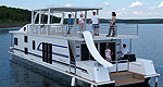
An interesting hike from Mt. Magazine to Cove Lake starts at the trail near the water pump in Cameron Bluff Campground. Along the 11-mile hike to Cove Lake, you will skirt wildlife openings, walk through stands of hardwoods and pine trees, follow a bluff line and stroll along picturesque streams. Another portion of the trail follows the shoreline around Cove Lake, with a spur trail leading to a vista overlooking the lake.
Details
Additional Details:
The trail has a long, steep section where it leaves the bluff line on Mt. Magazine. The remainder of the trail is generally 8 percent slope or less with some short stretches of steeper grades.
To preserve the scenic beauty of the area please stay on the trail and practice the Pack It In - Pack It Out .
Please remember, all terrain vehicles (ATVs) and horses are not allowed on the hiking trail.
Hikers need to bring their own drinking water.

