


As summertime water levels in the upper reaches of Arkansas's float streams drop, finding challenging whitewater to kayak or canoe usually depends on a hard rain. Even if nature obliges, the window of opportunity in upland watersheds generally isn't open long, making it difficult to plan an outing in advance.
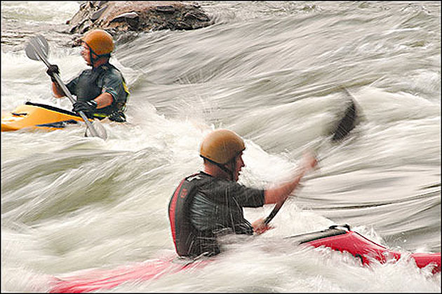
For the past few summers, though, a whitewater playground on the Ouachita River northwest of Malvern has been drawing a growing number of Arkansans, with visitors also reported from surrounding states and from as far away as Illinois. At the Rockport Ledge, a drop-off and collection of boulders that span the river a few hundred yards above Interstate 30, kayaking enthusiasts gather to practice skills such as rolls, ferries, eddies, surfing and freestyle tricks.
The water comes from upstream Lake Catherine in scheduled weekend releases, generating electricity as it passes under Remmel Dam. In addition, continuous but smaller releases have made the Ouachita between the dam and I-30 a reliable but gentle float throughout the year.