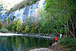


This trail begins at the Lost Valley campground and terminates in a cave 1-1/2 miles up the valley. Features include waterfalls, a cascading creek, towering cliffs, a large bluff shelter, a natural bridge, spring wildflowers and a hardwood forest containing American beech. The cave itself is a tight squeeze for approximately 200 feet ending in a large room with a 35-foot-tall waterfall. Clark Creek, like most tributaries to the Buffalo River, tends to dry up or go underground during the late summer and early fall of most years. The first mile to Eden Falls is level and easy going. The trail then climbs steeply to the mouth of the cave. Reliable lights will be needed for exploration of the cave.
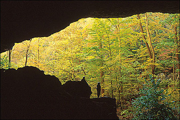
Beautiful creekside scenery, giant rocks and interesting canyon bluff formations. Cobb Cave, a huge bluff shelter that was home to early Indian cultures, is pictured here.