


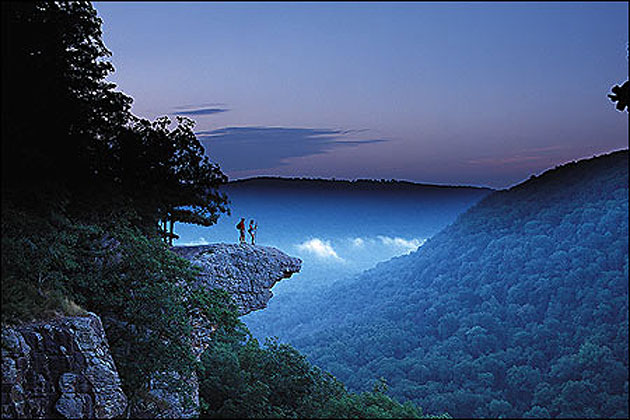
One of the most photographed spots in The Natural State is Whitaker's Point. To find this very remote location, take Ark. 21 to where it crosses the Buffalo River south of Boxley in Newton County. At the north end of the bridge (the end closest to Boxley), take a left turn on a gravel road.
Follow this steep, narrow and winding gravel road for 6.1 miles—at which point you'll encounter a U.S. Forest Service parking area (on the right side of the road) with a sign stating "Wilderness Access."
Park here, read all the notes and instructions which are posted, then cross the road and begin following the trail.
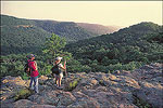
The trail is unmarked, although there's been enough foot traffic to make it plenty obvious. The distance to Whitaker Point is a mile or so (of easy to moderate difficulty) and will take some 30 to 60 minutes one-way depending on the hiker.